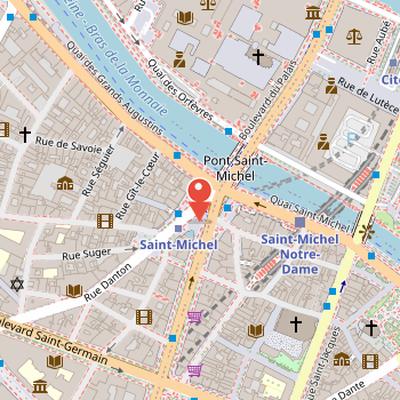
Place Saint-Michel is a square in the Latin Quarter of Paris, located at the border of the Quartier de la Sorbonne in the 5th arrondissement and the Quartier de la Monnaie in the 6th arrondissement. A square of the same name had existed further south until 1850, before disappearing during the construction of Boulevard Saint-Michel. The present square was created in 1855 under Napoléon III as part of that redevelopment. Its creation led to the disappearance of Place du Pont-Saint-Michel, parts of Rue Saint-André des Arts and Rue de l’Hirondelle, and Quai des Grands Augustins. The 14th-century Pont Saint-Michel was renewed along with the square, and the Fountain Saint-Michel on the south side was created by Gabriel Davioud in 1860. The square officially received its name in 1864. In August 1944, Place Saint-Michel was the site of fighting between French Resistance supporters and German occupiers, ending with the liberation of Paris on August 25 and 26, 1944 by Allied forces. The area is also served by Saint-Michel – Notre-Dame station and the Saint-Michel Métro station, and is surrounded by shops, cinemas, cafés, restaurants, and bookstores.
Nearby Objects
-
 Fontaine Saint-Michel 30 m away
 -
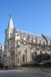 Saint-Séverin 200 m away
 -
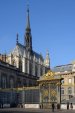 Sainte-Chapelle 250 m away
 -
 Shakespeare and Company 250 m away
 -
 Saint-Julien-le-Pauvre 300 m away
Location and historical change
Place Saint-Michel is a square in the Quartier Latin of Paris, on the border between the Quartier de la Sorbonne in the 5th arrondissement and the Quartier de la Monnaie in the 6th arrondissement. It is located in the capital city of France. A square with the same name once existed farther south until 1850, but it disappeared during the construction of Boulevard Saint-Michel.
Creation and Historical Role of Place Saint-Michel
Place Saint-Michel was created in 1855 under the rule of Napoleon III during the construction of Boulevard Saint-Michel. Its formation led to the disappearance of Place du Pont-Saint-Michel, parts of Rue Saint-Andre des Arts and Rue de l'Hirondelle, and Quai des Grands Augustins. At the same time, the 14th-century Pont Saint-Michel was renewed along with the square. The Fountain Saint-Michel on the south side of the place was created by Gabriel Davioud in 1860, and the square officially received its name in 1864. In August 1944, Place Saint-Michel was the site of fighting between French Resistance supporters and German occupiers. This fighting ended with the liberation of Paris on August 25 and 26, 1944 by Allied forces.
Transport Connections and Surroundings
The area around Place Saint-Michel is closely linked to public transport history. The Saint-Michel - Notre-Dame station was opened on May 28, 1900, and has been served by RER line C since 1979. In 1988, an orthogonally arranged station for RER line B was added. The Metro station Saint-Michel was put into operation on January 9, 1910. Around the square, there are boutiques, cinemas, cafes, restaurants, and several Gibert Jeune bookstores. The place also offers a view toward the buildings of Ile de la Cite, including the Palais de Justice, the police prefecture, and Notre-Dame de Paris cathedral.