Île de la Cité is an island on the Seine in the center of Paris, widely regarded as the ancient cradle of the city, formerly known as Lutetia. It belongs to the 1st arrondissement and another arrondissement, and covers an area of about 22.5 hectares. The island was fortified in 308 and was mentioned in 1190 by the chronicler Gui de Bazoches as the head, heart, and marrow of Paris. It is served by the Cité and Saint-Michel metro stations.
The name is linked to the Latin term “cité,” reflecting the period when Paris was limited to this island at the end of Antiquity. The oldest district continued to be called “la cité,” while other districts were later additions. The island was first designated as a city district around 954, during the first city division, and kept the same name and boundaries until the French Revolution. It was also called “île du Palais,” a name still sometimes used. Historical accounts note that the island’s area was originally 18 hectares, and archaeological digs in 1976 and 1977 revealed ancient layers under Gallo-Roman levels.
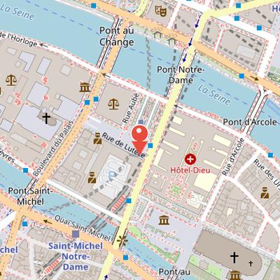
Nearby Objects
-
 Hôtel-Dieu de Paris 100 m away
 -
 Charlemagne et His Guards 200 m away
 -
 Sainte-Chapelle 200 m away
 -
 Palais de la Cité 250 m away
 -
 Shakespeare and Company 250 m away
Historic Core of Paris
The Ile de la Cite is an island on the Seine in the center of Paris and is considered the ancient cradle of the city, formerly Lutetia. It belongs to the 1st arrondissement and another arrondissement of Paris, and covers an area of approximately 22.5 hectares. The island was fortified in 308, indicating its early strategic importance. Its historical role was later emphasized by the chronicler Gui de Bazoches, who in 1190 described it as the head, heart, and marrow of Paris. In modern terms, the island had a recorded population in January 2016 and is served by the Cite and Saint-Michel metro stations.
The Name and Historical Boundaries of the Ile de la Cite
The name of the Ile de la Cite is linked to the Latin term "cite," reflecting the fact that Paris was limited to this island at the end of Antiquity. The oldest district of Paris continues to be called "la cite," while later districts are understood as additions. The island was first designated as a city district around 954, during the first city division, when it was called the "quartier de la Cite." At that time, the term "ville" was not commonly used. The district kept the same name and boundaries until the French Revolution. The Ile de la Cite was also known as the "ile du Palais," a name that is still used to some extent.
Early Settlement and Formation of the Island
Historians have generally estimated that a small Gallic tribe, the Parisii, lived in the area since around 250 BC, attracted by a region rich in fish and game and by the ease of crossing the Seine, which was then narrower. Two wooden footbridges are said to have extended a natural north-south route from the La Chapelle pass to the Sainte-Genevieve mountain, and a possible enclosure may have protected straw huts from enemy attacks. However, there is no archaeological evidence of Gallic presence on the island of Cite before the Roman conquest, and historians and archaeologists generally consider the Parisii settlement to have been located outside the island, near the Bièvre or Nanterre. A Gallic settlement discovered near Nanterre in 2003 was also not linked to occupation of the island.
Archaeological digs carried out in 1976 and 1977 by Venceslas Kruta revealed ancient layers beneath Gallo-Roman levels. At the time, the island of Cite originally covered 18 hectares, smaller than its present total area, and its riverbank stood about 50 meters farther back than the current banks because of river irregularities. Several small islets were later annexed to the island. Lutetia was founded in 52 BC after Julius Caesar's victory over Vercingetorix, and the Gauls are described as living on the island by fishing and boating while the Gallo-Roman city was built on the left bank.
Roman and Early Medieval Development
In the beginning of the common era, the island already contained a temple dedicated to Jupiter, built by the nautes. A Roman palace stood downstream, where the Roman representative resided, and the streets were arranged in a regular plan about three meters wide, lined with Roman houses. The cardo maximus crossed the island at the present rue de la Cite, following an older Gaulish path with stone and clay paving. Footbridges were replaced by two wooden pile bridges along this main axis, and the population was estimated at about 8,000. During the reign of Tiberius, the port quay of Lutetia was built to the southeast of the island.
The island later became a place of refuge during periods of invasion. Its inhabitants withdrew there after the Barbarian invasions in 276, and the population moved to the island again during the attack by Huns led by Attila, inspired by Saint Genevieve. In the mid-fifth century, a two-meter-wide enclosure was built about thirty meters from the Seine shores, with two large gates ten meters wide and fitted with wooden double doors on the cardo axis. The western palace later became the military residence of Caesar Julian in 357, and a large civil basilica, 122 meters long and 35 meters wide, stood opposite it at the current flower market site.
In 508, the island became the capital of Clovis, king of the Franks, who settled in the old Roman government palace. Between 511 and 558, the old Gallo-Roman temple was replaced by a large Christian basilica dedicated to Saint Stephen at the current Notre-Dame forecourt. The Gallo-Roman enclosure was demolished for this construction, which followed Constantinian basilica plans and used marble columns and capitals from the Nautes temple. The period also saw the erection of the baptistery Saint-Jean-le-Rond, the basilica Saint-Germain-le-Vieux, two female monasteries, Saint-Christophe and Saint-Martial, and a wooden oratory dedicated to Saint Martin. A violent fire in 586 destroyed the commercial district from the palace to the southeastern churches, and a prison near the Petit-Pont was also destroyed, allowing prisoners to escape.
Political and Religious Power on the Ile de la Cite
During the Carolingian period from 752 to 987, life in the capital was concentrated on the island, although the Cité lost its status as capital under Charlemagne when the court moved from city to city. The island was repeatedly struck by violence: it was pillaged, burned, and devastated by the Normans in 845, 856-857, and 861. In response, Charles le Chauve ordered the restoration and strengthening of the Gallo-Roman enclosure in 877. Two large towers, the Petit and Grand Chatelet, were then built to protect access to the bridges.
Religious institutions also marked the island. The abbeys on both banks built chapels on the island to shelter their treasures, and the chapels of Saint-Germain-le-Vieux, Sainte-Genevieve-la-Petite, Saint-Landry-des-Arcis, and Saint-Barthelemy were erected there. The island later became the focus of a major siege when seven hundred drakkars and forty thousand Vikings led by Sigfried appeared on the western bank of the Ile de la Cite. Bishop Gozlin of Paris refused them passage, leading to a long siege and the payment of tribute for their departure. Outside the Cité, everything was destroyed on both banks.
The political importance of the island increased after this period. Count Eudes de France gained from the victory and was elected king of West Francia, replacing Charles le Gros, who had delayed protecting the city. As the Robertians moved closer to Paris, the Ile de la Cite became the seat of power, and the count's palace became a royal residence. Hugues Capet rarely occupied it, but his successors made significant modifications to the palace. By 1112, the island was a large construction site, and King Louis VI le Gros took residence in the Palais de la Cite with his court and Parliament. The eastern part of the island was dedicated to episcopal power, while the commercial district around the Palu market supplied the king and bishop with precious goods. Most of the population lived on the right bank, known as outre Grand-Pont.
Urban Change on the Ile de la Cite
Around 1300, Guillot de Paris composed the first list of Paris street names in Le Dit des rues de Paris, which recorded 310 streets in the city, including 36 in La Cite. At that time, the Ile de la Cite was a densely built district with about five hundred houses separated by roughly forty unsanitary streets. Only the four main avenues had been paved since the reign of Philippe Auguste. The island was one of sixteen administrative quarters, and before the Revolution it still contained ten parishes out of fourteen earlier parishes.
Its political and architectural center was the Palais de la Cite, expanded by Saint Louis and Philippe Le Bel. The royal family later abandoned it by decision of Charles V in favor of the Louvre, and Charles VII permanently left the palace to the Parlement. The island also contained major commercial and crossing points. The Pont-aux-Changeurs housed one hundred merchants, while Pont Saint-Michel was built in stone in 1379 south of Pont-aux-Changeurs. Pont Notre-Dame replaced the old Milbray planks footbridge in 1413. Heavy chains extended the city walls over the water to regulate river access.
In the late 16th and early 17th centuries, the island was reshaped by major works linked to the Pont Neuf. Henri III laid the first stone of the bridge to connect both riverbanks via the island's downstream tip, and Henri IV completed it in 1607. Three islets north of the Ile de la Cite were annexed, and construction of the quai des Orfevres and quai de l'Horloge began in 1580. Henri IV also assigned Achille de Harlay to create a commercial area around the future Place Dauphine, and a statue of Henri IV was erected at the island's tip in 1614. The bridge program was intended to end river crossing through the island, which slowed its development.
Urban change continued with rebuilding after a fire in 1618, the creation of Rue de Harlay around 1607, Rue Saint-Louis in 1623, and Rue Sainte-Anne-en-la-Cite in 1630. Pont au Change was rebuilt between 1639 and 1647 with two rows of houses. In the 18th century, urban rules rectified building alignment, imposed straight layouts, and changed facade materials; a 1784 decree also ordered the straightening of Rue de la Barillerie between Pont au Change and Pont Saint-Michel. After the winter floods of 1801-1802, the island was surrounded by quays, and later Constantine Street and Arcole Street were opened under Louis-Philippe, the latter extending the new Arcole bridge and replacing narrow and muddy streets. In the Revolution, the island was renamed Ile-de-la-Fraternite. Later, the Fourierist Perreymond suggested reconstructing it as a religious and cultural center.
Haussmannian Transformation Around Notre-Dame
The area around Notre-Dame on the Ile de la Cite was radically altered during the 19th century through a reconstruction and demolition program associated with Historique, Viollet-le-Duc, and Baron Haussmann. Historique's reconstruction plan included an opera house and a large library, while Viollet-le-Duc planned a large episcopal palace near the cathedral and rebuilt the sacristy of Notre-Dame. At the same time, Baron Haussmann ordered major clearances between the Palais de Justice and Notre-Dame cathedral, including the eastern apse area. This demolition removed hundreds of houses and several small churches, and inhabitants were expelled during the process. Some historic elements were preserved, notably Place Dauphine and the Notre-Dame cloister. On the cleared land, the Cite barracks and police prefecture were built, along with the commercial tribunal. The urban layout was also reorganized: Boulevard du Palais replaced the rue de la Barillerie, rue de la Cite absorbed the old Market-Palu, Juiverie, and Vieille-Lanterne streets, and rue de Lutece replaced rue de Constantine. Notre-Dame square was expanded to six times its medieval area. Further changes included the demolition and rebuilding of the Hotel-Dieu farther north between 1868 and 1875, the removal of canon houses and about twenty sanctuaries around Notre-Dame, and the destruction of buildings on rue d'Arcole that were about twenty years old.
The Shape and Urban Fabric of the Ile de la Cite
L ile de la Cite is surrounded by two arms of the Seine, the Grand bras to the north and the Petit bras to the south. Its oblong shape was compared by Victor Hugo in Notre-Dame de Paris to a cradle. Excavations carried out in 1990 on rue de Harlay studied the island's formation and later evolution. According to the geological record given here, the site formed from a sandbank around 5250, and the plateau rose from 26 meters to 30 meters during the Bronze Age. During the La Tene period, the area underwent long phases of immersion, while quieter periods allowed channels to cut the emerging island. The narrowest prehistoric width of the two Seine arms was shaped by the surrounding landforms, including the mountain Sainte-Genevieve to the south and the monceaux Saint-Merri and Saint-Gervais to the north. A seven-meter-high cliff in the limestone platform marked the riverbank on the right bank northwest of the island.
The island's geographic features facilitated communication with both riverbanks. Over time, human activities and fill accumulation raised the island by eight meters compared with previous levels, and artificial sedimentation helped protect it from Seine floods. Bridges became central to circulation, trade, and defense. Nine bridges now cross the Seine, replacing two ancient wooden footbridges. These earlier bridges were frequently destroyed by floods, fires, or enemy attacks, yet they also served defensive roles during invasions and supported movement essential to the Cite and the development of the city. At the end of the Middle Ages, five bridges existed and were lined with housing and heavily congested. Boats also provided transport for people and goods across the river at the same time. Until an unspecified date, the Ile de la Cite was a maze of streets built on both sides.
The island now includes about twenty streets, squares, and quays, compared with forty-three in 1300. Its quays are divided into six sections, and it also includes the allée Célestin-Hennion, boulevard du Palais, promenade Maurice-Carême, and about ten streets. Green spaces include the square du Vert-Galant at the west tip, square de l Ile-de-France at the east tip, square de la Place-Dauphine, the gardens around Notre-Dame, and the jardinet de la Rue-des-Ursins. The gardens around Notre-Dame are named jardin de la Place-Jean-Paul-II and square Jean-XXIII, formerly jardin de la place du Parvis-Notre-Dame and square de l Archeveche. Other notable squares include place du Pont-Neuf, place Dauphine behind the palais de justice, parvis Notre-Dame - place Jean-Paul-II, and place Louis-Lepine with a flower and bird market. The garden of the Palais de la Cite has existed since the reign of Saint Louis at the western tip, and the construction of the Pont Neuf began in 1578 with several green tunnels bearing vine shoots.
Administrative Divisions of Ile de la Cite
The administrative history of ile de la Cite is marked by repeated changes in its division and naming. According to administrative statements, boulevard du Palais today defines the boundary between the arrondissement du Louvre and the arrondissement de l'Hotel-de-Ville. The part on the Louvre side belongs to quartier Saint-Germain-l'Auxerrois, while the part on the Hotel-de-Ville side forms, together with ile Saint-Louis, the quartier Notre-Dame. This arrangement is said to date from the convocation aux Etats generaux of 1789.
The earlier quartier de la Cite is described as one of the four first administrative divisions of the city, although its origin is uncertain, like that of Saint-Jacques-la-Boucherie, la Verrerie, and la Greve. During the Middle Ages, true communal divisions did not exist and were replaced by the parish framework. Because insecurity in quartier de la Cite was a concern, the prevot des marchands established a framework of quartiers with cinquantaines and dizaines. Quartier de la Cite became the first of sixteen quartiers inside the enclosure of Charles V, and it took the name Notre-Dame before resuming the name La Cite in the municipal reform of 1680.
At the Etats generaux of 1789, Paris was divided into sixty districts, and the island was divided into two districts for the first time. The district des Barnabites covered the west of the rues de la Lanterne, de la Juiverie, and du Marche-Palu, while the district Notre-Dame covered the eastern part of the island. Ile Saint-Louis represented a separate district. On June 27, 1790, forty-eight revolutionary sections were created. Section Notre-Dame covered the part of the island east of rue de la Barillerie and met in the chapter room of Notre-Dame, while the western part was covered by section Henri-IV, also known by names including section du Pont-Neuf and section Revolutionnaire.
On October 11, 1795, twelve arrondissements were created, maintaining the division of ile de la Cite between arrondissement du Palais and arrondissement de la Cite. The arrondissement du Palais mostly extended on the right bank, and the arrondissement de la Cite mostly extended on the left bank. The 1795 quartiers respected the unity of the island, with the western part as quartier du Palais de justice and the eastern part as quartier de la Cite.
Population Change and Urban Reshaping
Demographic records show population changes on Ile de la Cite through censuses taken since 1800. A marked decline occurred in the 1860s during Haussmannian works, which demolished most of the island's residential neighborhoods and replaced them with administrative and hospital buildings. Today, the population is concentrated in a few remaining areas, especially around Place Dauphine, at the west angles of the Prefecture of Police, and mainly in the block between rues d Arcole, du Cloitre-Notre-Dame, and quai aux Fleurs. Recent population decline has been linked to the growth of tourist furnished rentals, with property owners often preferring short-term tourist leases over long-term rentals.