The Boulevards of the Marshals form a circuit of traffic arteries encircling Paris, France, inside the city limits. Their route follows the former Rue Militaire, built in the 1840s as part of the Thiers Fortifications. Initially a service road for transferring soldiers and delivering supplies, it later became secondary in the city’s defense and part of Haussmann’s efforts to improve Paris’s arterial streets. The city obtained rights in 1859 to widen, pave, and equip it with sidewalks, and after the annexation of outer districts in 1861 secured authorization to expand it to boulevard width. In 1864, Rue Militaire was divided into nineteen sections named after marshals who served under Napoleon I. The collective name Boulevards of the Marshals came into use in the 20th century. The circuit was served by PC buses from 1951 to the early 2000s, when they were replaced by the Tramway des Maréchaux except in the 16th arrondissement.
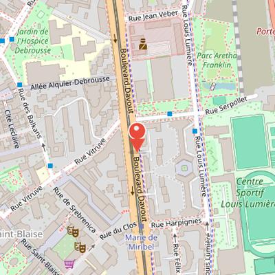
Nearby Objects
-
 Communards' Wall 700 m away
 -
 Grave of Victor Noir 950 m away
 -
 Père Lachaise Cemetery 1100 m away
 -
 Frédéric Chopin’s tomb 1200 m away
 -
 The Triumph of the Republic 1600 m away
Naming and Development
The Boulevards of the Marshals are traffic arteries that encircle Paris inside the city limits. Their development began in the 1860s under Napoleon III, who named nineteen boulevards after marshals who served under Napoleon I. The name Boulevards of the Marshals came into use during the 20th century. The circuit was served by PC buses from 1951 to the early 2000s, when they were replaced by the Tramway des Maréchaux except in the 16th arrondissement.
From Rue Militaire to the Boulevards of the Marshals
The Boulevards of the Marshals occupy the route of the former Rue Militaire, which was built in the 1840s as part of the new Thiers Fortifications encircling Paris. Rue Militaire originally served as a military service road, used to transfer soldiers and deliver supplies, before being relegated to a secondary role in the citys defense. It later became part of Haussmanns effort to improve Paris arterial streets. In 1859, the city obtained rights from the Army to improve and maintain the road, with the intention of widening it to six meters, paving it, and adding sidewalks.
The citys annexation of outer districts in 1861 expanded the limits of Paris to the fortifications, and authorization was then secured to widen Rue Militaire to the standard boulevard width of forty meters. Where necessary, civilian property inside the loop was expropriated. In 1864, Rue Militaire was divided into 19 sections, each named after a Marshal of Napoleon I. This naming reflected Napoleon IIIs practice of anchoring the legitimacy of his regime on the Bonaparte family. The boulevards were intended as a ring road boulevard, but no official collective name was given, and only a few short stretches were rebuilt as actual boulevards during the Second Empire.
The circuit also developed alongside the Chemin de fer de Petite Ceinture, whose route began in the 1850s and usually lay 100 meters further inside than Rue Militaire. In peacetime, it transported merchandise and passengers between the capitals six mainline railway stations. Much work on the circuit was carried out over thirty years to encourage development in the less populated outer districts. The fortifications were ceded to the city in 1919 and demolished over the following decade.
From Arterial Road to Urban Thoroughfare
Further improvements to the Boulevards of the Marshals were prompted by urban development and the advent of the automobile. By 1939, all of the boulevards had central carriageways 20 meters wide, and from the 1930s they were served by the PC bus. The presence of both automobiles and buses encouraged the idea that the separate segments formed a single circular thoroughfare. In this respect, they were compared with the Grands Boulevards in central Paris and the Exterior Boulevards served by Metro Lines 2 and 6.
After World War II, Paris increasingly embraced the motorway as automobile use and traffic volume grew. The Boulevards of the Marshals were judged inadequate because of heavy use, and they were reengineered to allow traffic to approach motorway speeds and volume. This work included widening carriageways, reducing traffic lights and pedestrian crossings, and building underpasses at major intersections. Much of the system was rebuilt again in the early 2000s, when automobile policy changes in Paris also included restricting parking, promoting mass transit and cycling, and redesigning traffic arteries. The aim of this later rebuilding was to create a more pedestrian-friendly environment.
The later history of the boulevards is also linked to the Boulevard Peripherique, built between 1956 and 1973 on a 250 meter-wide field-of-fire belt bordered by the now-demolished fortifications. That motorway was designed for high-speed driving and limited access, and few people referred to it as a boulevard, marking a clear difference from its 19th-century predecessor.
Tramway Reconstruction and Urban Aims
New tramways were installed along 85 percent of the Boulevards of the Marshals circuit. The tramway and boulevard remake was designed to provide greater public transport capacity than PC buses, while reducing the presence of cars and related services. It also aimed to reclaim public space, stimulate commercial and community life, and narrow the livability gap compared with Paris' poorer suburbs.
Alterations to the Marshalling Scheme
The Boulevards and the Marshals concept was altered just as it was coming to fruition, and later renamings further weakened its original logic. In 1932, a section of Boulevard Lannes was renamed Boulevard de l Amiral Bruix. Étienne Eustache Bruix had been a high-ranking naval officer and administrator under the Directory and Consulate, but he was not a marshal or a naval equivalent. Similar departures from the intended pattern occurred much later. In 1987, a section of Boulevard Victor became Boulevard du General-Martial-Valin. Valin had commanded the Free French air force, was a hero of the liberation of Paris, and later held other high military posts until the 1960s, but he was never granted the distinction of Marshal. In 2005, a section of Boulevard Massena was renamed the Boulevard du General-Jean-Simon. Simon had a distinguished military career with the Free French and the postwar army, and he was also active in civic and military associations honoring the Liberation in the late 20th century, yet he too was not a marshal. As a result, the Boulevards and the Marshals never included all 26 of Napoleon s marshals. Seven were omitted from the new names bestowed on the Rue Militaire in 1864, and several figures connected to the Napoleonic and post-Napoleonic periods stood outside the marshal list itself. Napoleon removed Pierre Augereau, Auguste de Marmont, and Catherine-Dominique de Perignon during the Hundred Days. Charles-Jean-Baptiste Bernadotte later ceased to be a French marshal when he became Crown Prince of Sweden in 1810 and then joined the Sixth Coalition. Emmanuel de Grouchy received the marshal title in 1815, but was later proscribed by the Bourbons and vilified by Bonapartists for his decisions at the Battle of Waterloo.
Street Names and Marshal Commemoration
Several Paris streets were named after Marshals of the Empire, linking their memory to the citys street network. Bon-Adrien Jeannot de Moncey was commemorated by rue Moncey in 1844, and Nicolas Charles Marie Oudinot by rue Oudinot in 1851. Rue Moncey is in the 9th arrondissement, while rue Oudinot is in the 7th arrondissement. Both were minor streets, and their names could have been changed if they had been given a boulevard segment. Moncey and Oudinot did not rejoin Napoleon during the Hundred Days. Other Marshals who also did not rejoin him included MacDonald, Massena, Suchet, and Victor. Pierre Augereau, who burned political bridges with both the Bourbons and the Bonapartists during the regime changes of 1814-15, was also honored by rue Augereau in the 7th arrondissement, although the street was renamed by its proprietors in 1894 as a private street.
Route and Connections of the Boulevards
The list of boulevards begins at the Porte de Vincennes in Paris and continues in ascending numerical order of arrondissements from the 12th to the 20th. It follows a clockwise direction around Paris, starting from the 3:00 position. The list also records each boulevard's connections to the Paris Metro, the RER, and Paris Tramway Line 3. In addition, it notes links to the city gates of Paris and to the main roads leaving the capital for adjacent communes.
Transport and circulation
The Boulevards of the Marshals are regulated as ordinary urban roads, with a general speed limit of 50 km/h. Transportation authorities state that they do not form an expressway or limited-access motorway in the manner of the Boulevard Peripherique. Much of the circuit is served by the Paris Tramway system, which covers most of the boulevards. Two tram lines share a terminus at Porte de Vincennes: line 3a follows the boulevards along the southern half of the circuit, while line 3b follows the northern circuit. There is no tramway on the section near the Bois de Boulogne, between the Pont du Garigliano and Porte Dauphine, where service is provided by the last surviving PC bus route. Bicycle lanes have also been installed along parts of the boulevards.