The castrum de Dijon is an ancient Gallo-Roman urban enclosure in Dijon, Bourgogne. Built between the third quarter of the 3rd century and the beginning of the 4th century, it surrounded an enclosed urban area of about 5.5 hectares with a rampart approximately 800 meters long. The enclosure had a trapezoidal plan with rounded corners, and its foundations in some places reused older leveled buildings and building elements.
Only a few archaeological remains are still identifiable today. The remains of the tour du Petit Saint-Bénigne are the only part visible in elevation and have been classified as historical monuments since 1840. In the modern city, several streets outline the former route of the enclosure a few meters away, although the eastern flank is not identifiable in present-day street layouts. The castrum was built on a part of the antique city with rocky subsoil, between two talwegs northwest of the Ouche. Gregory of Tours stated that the Suzon was partially diverted to supply the moat with water.
Nearby Objects
-
 Musée Magnin 60 m away
 -
 Place Émile-Zola 110 m away
 -
 Place de la Libération 110 m away
 -
 Musée des Beaux-Arts de Dijon 140 m away
 -
 Sainte-Chapelle de Dijon 140 m away
Archaeological Remains in Dijon
The Castrum de Dijon is an ancient Gallo-Roman urban enclosure built between the third quarter of the 3rd century and the beginning of the 4th century. Some archaeological remains survive in Dijon, in Bourgogne. Among them, the remains of the tour du Petit Saint-Benigne are the only part of the enclosure still visible in elevation. These remains have been classified as historical monuments since 1840.
Location and Urban Traces
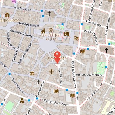
The Castrum de Dijon was built between two talwegs northwest of the Ouche, on a section of the ancient city with rocky subsoil. According to Gregory of Tours, the Suzon was partially diverted to cross the site and supply the moat with water. In the modern city of Dijon, several streets outline the route of the castrum a few meters away from its original line. Rue Longepierre lies to the north, Rue du Bourg marks the northeast corner, and Rue de la Charrue together with Rue du Petit-Potet lie to the south. Only the eastern flank of the castrum cannot be identified in the present street layout.
Early History of the Castrum de Dijon
The site of Dijon was occupied before an unspecified date, but the importance and exact nature of this early occupation are poorly known. It is also impossible to determine whether this occupation overlapped geographically with the city of the Late Roman Empire. Historique cites Grégoire de Tours for a construction dated between 270 and 275, though it is more probably placed in the early 4th century in northeastern Gaul. The construction is described as accompanying a modification of the city street plan during the Roman High Empire. The enclosure still existed in the 5th century, but it gradually lost its defensive role as the urban fabric expanded.
Rampart and Fortification Plan
The Castrum de Dijon was protected by a rampart approximately 800 meters long, enclosing an urban area of 5.5 hectares. The enclosure had a trapezoidal plan with rounded corners. In some places, older leveled buildings were used as foundations for the rampart, while in others reused building elements were found in the foundation trench.
The curtain wall was described by Gregory of Tours as two meters thick and six meters high, dimensions that were also consistent with excavated remains studied in the early 20th century. Excavations indicate a thickness varying between 1.5 and 2 meters. These measurements are typical of Late Empire fortifications. The wall was built with two facings enclosing a rubble core of stone and mortar. The inner facing used small blocks, while the outer facing used larger blocks. The masonry also combined alternating small blocks with layers of flat stones, without architectural terracotta.
Along the curtain wall route, there were thirty-three towers spaced about 25 meters apart, of which nineteen have been precisely located. Some of these were semi-circular towers, 6 meters in diameter, projecting 3 meters from the external wall face.
Enclosure, Gates, and Ditch
The enclosure of the Castrum de Dijon is described as having two gates, located at the north-west and south-east, although the south-east position is imprecise. It also had at least two posterns, one at the north-east and one at the south-west, each flanked by a tower. At the foot of the enclosure there was a ditch, said by Gregory of Tours to have been filled by waters diverted from the Suzon. Traces of this ditch were reported repeatedly between 1940 and 1992. The ditch may have been set at some distance from the enclosure in order to avoid weakening the foundations, and it may also be later than the enclosure itself.
Surviving Remains of the Castrum
The most notable surviving element of the Castrum de Dijon is the ruined tower known as the tour de la Vicomte or tour du Petit Saint-Benigne. Converted into a chapel in the Middle Ages, it stands in the courtyards of houses 13 and 15 rue Charrue and was designated a historical monument on 14 July 1925. It is the only tower partially preserved in elevation. Its ground floor probably dates from the Gallo-Roman period, while the upper floor may have been rebuilt in the 14th or 15th century.
Other remains of the castrum are integrated into walls and private gardens, including at 7 rue Hernoux, 40 rue Amiral-Roussin, the Palais des ducs de Bourgogne, and the Musee Rude of Saint-Etienne church on the Philippe Pot street side. A visible subsoil portern vestige is also preserved at the Musee Rude site.