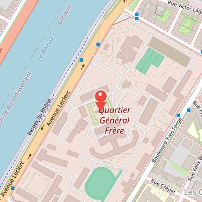
Fort de la Vitriolerie is a work of Lyon’s first belt and is now better known as Quartier Général-Frère in Lyon. Construction began in 1840 and was completed twenty years later. The fort was designed in a triangular shape with two offensive sides facing south and east, equipped with 66 cannons. Its plan also included a caponiere and two demi-bastions. The fort’s barracks were originally two stories high and housed an unspecified number of people; a third story was added in 1860. During the Lyon Commune episode, the fort was stormed by popular quarters’ national guards seeking arms against bourgeois quarters’ national guards. The site later became the Vitriolerie barracks and, in 1968, Quartier Général Frère.
Nearby Objects
-
 Prison Saint-Paul 550 m away
 -
 Sainte-Blandine de Lyon 600 m away
 -

-
 Brasserie Georges 700 m away
 -
 Comoedia 700 m away
From Fort de la Vitriolerie to Quartier General-Frere
Fort de la Vitriolerie is a work of the first belt of Lyon. It was originally known as the Fort de la Vitriolerie, but it is now better known as Quartier General-Frere in Lyon. The change in name reflects its later public identity, while its place within the first belt remains part of its historical description.
Design and Later Uses
Fort de la Vitriolerie was begun in 1840 and completed twenty years later after an expropriation ordinance had been delivered. It was designed in a triangular shape with two offensive sides facing south and east, equipped with 66 cannons. The fort also included a caponiere and two demi-bastions. Its barracks were originally two stories high and housed an unspecified number of people, and a third story was added in 1860. During the Lyon Commune episode, the fort was stormed by national guards from the popular quarters seeking arms against the national guards from the bourgeois quarters. Later, the fort became the Vitriolerie barracks and, in 1968, the Quartier General Frere.
The engraved number at the entrance
Altimetrie notes that the engraved number 493 at the entrance of Fort de la Vitriolerie does not fit the calculation method used for the number 380 on the entrance of Fort Saint-Irenee. While 380 is explained as an altitude in feet referenced to a ruler on the Saone quay near Bonaparte bridge, this approach is said to be inapplicable to 493. Altimetrie also reports that Fort Saint-Irenee is higher than Fort de la Vitriolerie according to an IGN plaque. An ASSIL study proposes that the engraved number is not expressed in feet, but instead indicates a negative altitude relative to a high point, possibly corresponding to Fort du Mont Verdun. Members of ASSIL supported this theory by taking additional measurements of structures with similar inscriptions. Altimetrie further states that the sum of the engraved altitude and the IGN-measured altitude always indicates the same reference elevation.