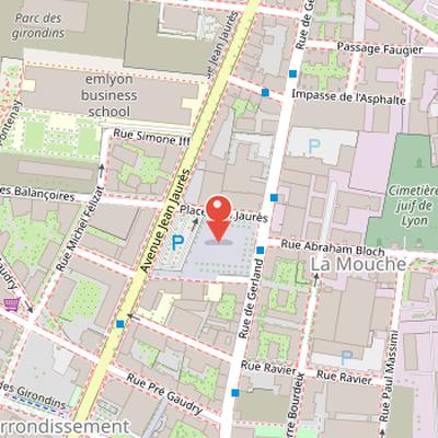
Place Jean-Jaurès is a square defined by a set of surrounding streets and buildings. Its west side is bordered by avenue Jean-Jaurès, and its east side by rue de Gerland. On the south side, the square is edged by buildings and the public primary school François-Auguste-Ravier. A street on the north side connects rue de Gerland and avenue Jean-Jaurès, and access to a parking area is available on the west part of the place from this northern street. The name of the square refers to Jean Jaurès (1859–1914), a French socialist politician. The name was attributed by municipal deliberation.
Nearby Objects
-
 Gare de Lyon-Guillotière 550 m away
 -
 Avenue Jean-Jaurès 650 m away
 -
 Avenue Berthelot 650 m away
 -
 Place Jean-Macé 750 m away
 -
 Fort de la Vitriolerie 800 m away
Location and Access
Place Jean-Jaures is bordered by avenue Jean-Jaures on its west side and by rue de Gerland on its east side. On the south side, it is lined by buildings and by the public primary school Francois-Auguste-Ravier. A street on the north side connects rue de Gerland and avenue Jean-Jaures, providing access to a parking area in the western part of the place.
Name Origin
The name of Place Jean-Jaures refers to Jean Jaures (1859-1914), a French socialist politician. The attribution of this name was made by municipal deliberation, showing that the choice was formally adopted by the local authorities.